
Okay, I pretty much feel like crap today and really am not into anything serious. And yes, I was out last night to play. It is what it is.
But put on your tin foil hats today. There really isn’t going to be much science in this article, and to be honest, I don’t buy the accepted explanations about the Piri Reis map that the “experts” want us to believe.
And Gadget (ChatGPT), you’re probably going to get shot down more often than not when you try to correct what I write based on what YOU think is accurate.
So, hold onto that tin foil hat. We’re off to the races.
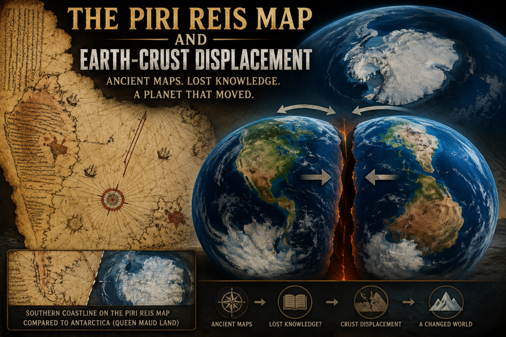
To start, I need to explain what the Piri Reis map is. This is a world map from 1513 that shows more of the world than what was generally known at the time. It shows South America and, according to some interpretations, what appears to be the coast of Antarctica.
Now, remember that this map is from 1513, when much of the world had not yet been fully explored or mapped. What is intriguing about the map is the detail it shows in South America, including rivers and mountains. And, to be honest, I don’t believe anyone had discovered the South Pole or Antarctica at that point.
Here is a link from UNESCO that has some good images of the map. There are plenty of others that can be found if you want to do a little searching yourself.
Now, because I just don’t buy the “experts'” opinion, or at least I don’t buy it today, let’s look at the southern portion of the map.
The UNESCO article states that this is Terra Australis. I don’t buy that explanation. I believe what we’re actually looking at is the coastal region of Antarctica.
Because the original site I referenced above gave us squat for information about this, I now refer you to Wikipedia.
God, I hate using Wikipedia as a reference. But what I read there is pretty much what I already knew.
Piri Reis is the actual person that penned this map, and he presented the 1513 world map to Ottoman Sultan Selim I (r. 1512–1520).
“It is unknown how Selim used the map, if at all, as it vanished from history until its rediscovery centuries later. When rediscovered in 1929, the remaining fragment garnered international attention as it includes a partial copy of an otherwise lost map by Christopher Columbus.”
And here is what the experts think about this map. Blah, blah, blah. Same old song and dance when they can’t prove or disprove something: Listen to us. We are the experts.
“There are conflicting interpretations of the map. Scholarly debate exists over the specific sources used in the map’s creation and the number of source maps] Many areas on the map have not been conclusively identified with real or mythical places.[3] Some authors have noted visual similarities to parts of the Americas not officially discovered by 1513, but there is no textual or historical evidence that the map represents land south of present-day Cananéia.[4] A disproven 20th-century hypothesis identified the southern landmass with an ice-free Antarctic coast.”I removed some of the Wikipedia reference links because they didn’t tell me jack shit. If you want to go through all of the original reference links yourself, they’re still available in the Wikipedia article that I linked to above.
The main one I removed was the reference behind the claim that the southern portion of the map being an ice-free Antarctic coast had been “disproven.”
Honestly, if I had found actual material there that made me change my mind, I would have said so. I didn’t.
So, screw you with this “disproven” crap. Okay, to this point I am saying that we have a map of the world from 1513 that shows areas of the world in more detail than should have been known at that time.
I haven’t even gotten to the really cool part yet, though.
Lol, Gadget provided me with some information that was later talked about concerning Earth-crust displacement.
Cool, huh?
Told you. Tin foil hat time.
So, first, let’s talk about what Earth-crust displacement is.
In general, the Earth’s crust sits on top of the mantle. Or, to put it another way, the tectonic plates that make up the Earth’s outer surface can move over the hotter, slowly flowing material beneath them.
This movement is what gives us continental drift and tectonic activity.
In 1958, Charles Hapgood wrote a book titled Earth’s Shifting Crust: A Key to Some Basic Problems of Earth Science. The link takes you to the book on Archive.org. I’m not sure if the entire book is available there, but at least if you want to dive into this rabbit hole yourself, you have someplace to start.
A Google search of what Hapgood proposed gives us the following basic ideas, along with the “experts'” response.
Core Ideas
- Crustal Displacement: Hapgood suggested that Earth’s outer shell can slide as a whole over the inner layers.
- Polar Ice Caps: He argued that weight from accumulating polar ice creates an unbalanced centrifugal force that triggers these rapid shifts.
- Fixed Axis: The theory states the entire crust moves, while Earth’s overall rotational axis stays in place.
- Historical Impact: Hapgood used this concept to explain past ice ages, mass extinctions, and sudden climate changes.
Scientific Reception
- Einstein’s Foreword: Albert Einstein wrote the foreword for the original 1958 edition, showing brief interest in the mechanical plausibility of the idea.
- Mainstream Rejection: Modern geologists and geophysicists do not support the idea of rapid, whole-crust displacement.
- Plate Tectonics: Standard earth science explains surface motion through slow plate tectonics rather than sudden global sliding.
Ok, now how does this tie into the map you ask? Well, let me tell you.
Hapgood believed the strange southern landmass on the map was Antarctica, specifically that it preserved geographical information originating from a time when parts of Antarctica were not covered by their present ice sheet.
Hapgood developed the crust-displacement idea first. Earth’s Shifting Crust came out in 1958. His detailed arguments about ancient maps came later in Maps of the Ancient Sea Kings, published in 1966.
His proposed connection essentially worked like this:
1. The Piri Reis map was drawn in 1513.
Piri Reis said he compiled his map using older source maps.
2. Hapgood believed some of those sources were extremely old.
Not merely maps from Portuguese explorers or Columbus-era voyages. He thought some geographical information had been copied and recopied from maps originating thousands of years earlier.
3. He interpreted the southern landmass as Antarctica.
More importantly, he argued that it represented Antarctica in a condition different from the heavily glaciated continent we know today.
4. That created a rather enormous question:
If somebody mapped Antarctica before its modern ice coverage, when the hell was that mapping done?
5. Earth-crust displacement became part of Hapgood’s answer.
Under his hypothesis, Antarctica had previously occupied a different position relative to the South Pole. A major displacement of Earth’s crust subsequently moved it into its present polar location, where extensive glaciation followed.
So, as noted above, the Piri Reis map was created using older maps, some of which may have originated long before exploration of the unknown parts of the Earth really started making headway. Or, at least, long before what we recognize as the Age of Exploration today.
According to Hapgood’s theory, some of those source maps were extremely old. So old, in fact, that they could have represented the Earth before a major displacement of the crust changed the positions of landmasses relative to the poles.
Now, there is an important distinction here. Normal continental drift and plate movement don’t dramatically rearrange the Earth over a few hundred years. We’re generally talking about geological timescales of millions of years.
Hapgood, however, was proposing something much more dramatic: that the Earth’s outer crust could undergo a major displacement over a much shorter period of time.
Oh, come on, everyone. This is some serious shit here.
What if the normal drifting of continents occurred much more rapidly at some point in Earth’s history? And honestly, there could be several possible explanations for why something like that might have happened.
Could the Earth have been slammed by a massive comet or asteroid that somehow triggered a shift in the Earth’s crust? Could some sudden change in the Earth’s rotation have contributed to something like this? We know that massive earthquakes and other geological events can measurably affect the Earth’s rotation and redistribute enormous amounts of mass. Could a much larger catastrophe have produced a much larger effect?
I don’t know.
Remember, we’re wearing the tin foil hats today.
But let’s take this rabbit hole one step further. Could this crustal shifting have occurred during a previous cycle of civilization on Earth?
Chuckle.
Which, of course, leads us right back to another question I’ve already played with:
Is this really the only technological phase in the history of Earth’s population?
Man, I love it when I can reference a previous article I wrote in a totally different topic. I warned you in the beginning that this was a tin foil hat article.
But honestly, most of the technical stuff I’ve been writing about is starting to rub me the wrong way. Not because of the technology itself, but because of all the controversy surrounding the advancements we’re making. The die-hard haters of anything new. The expert opinions. The propaganda. Everybody seems to have an agenda.
So, screw it. I just want to have some fun.
My other article was written for much the same reason. If these haters want something to get their panties in a bunch over, I can certainly give them something.
And I have fun doing it.
Pingback: Atlantis: Real or Fictional? - Dans Geek Stop Blog